
Today the weather did not cooperate, so it was off to the classroom for a lesson on airspace. I really enjoyed this lesson because we actually broke out the sectional chart and studied the airspace around Danbury. This was the first lesson that touched on topics used when actually taking the plane someplace, as opposed to the early lessons which were focused on flight theory and how to properly control the aircraft during maneuvers. There was something very exciting about this and it felt like I had reached another milestone (albeit a small one) in my training.
The airspace in the US is incredibly complex, and looking at a sectional chart is overwhelming at first. There is a ton of information packed into these charts! Here’s a small portion of the New York Sectional showing my home airport of DXR (click for a larger version):
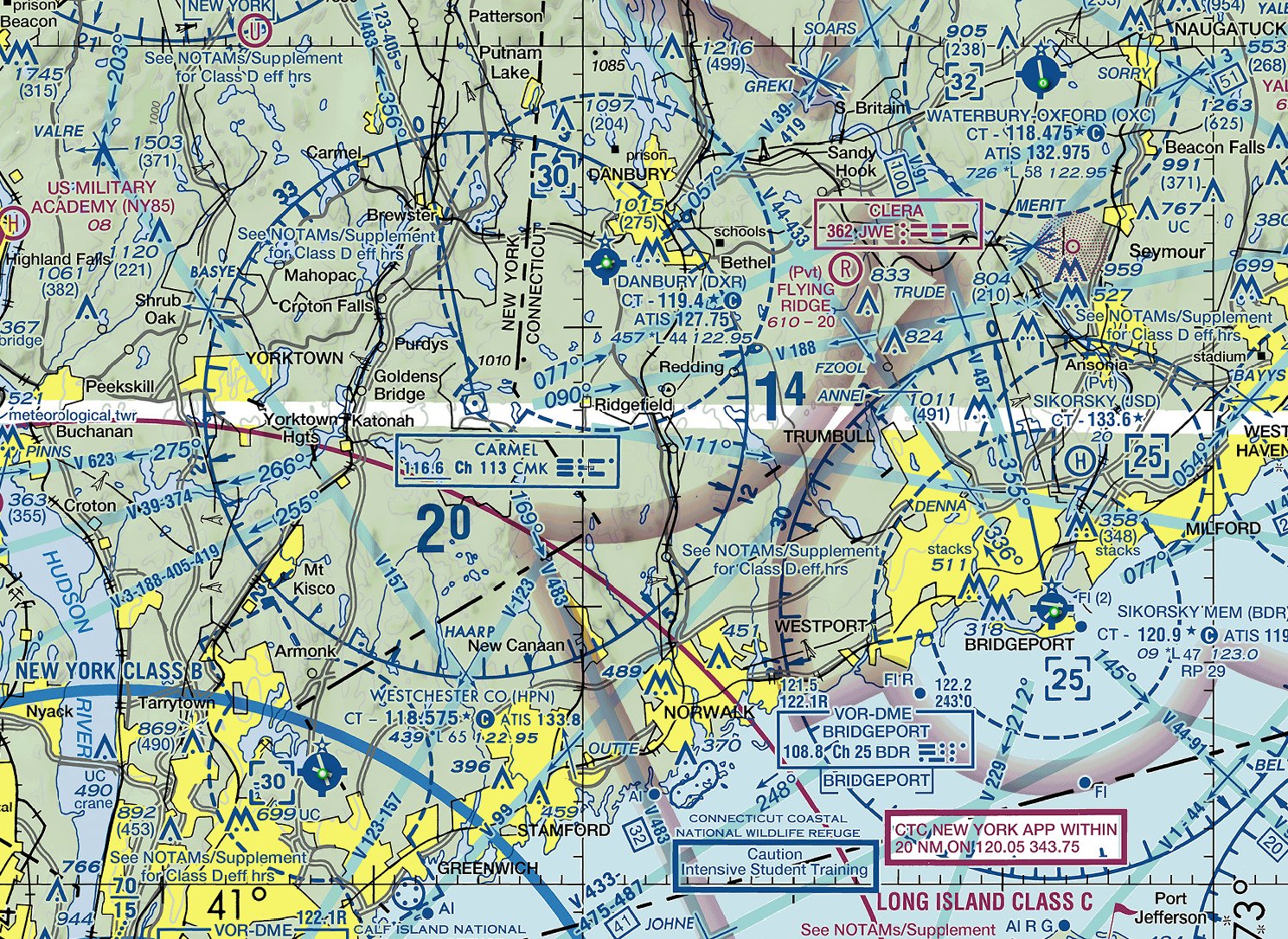
Understanding airspace is really important around Danbury, as we have a lot of heavy-duty airspace very close to our airport. We’re a stone’s throw from the massive NYC Class Bravo, and the entire NY metro area can get very busy at times. That is one reason it will take me a while before I am signed off to solo — my instructor has to be sure I won’t accidentally find myself flying over JFK or into the flight path of an arriving 747!
I purchased my own copy of the NY sectional chart and will start studying it at home. Another great resource is SkyVector, a flight planning website which has stitched together all of the US sectional charts, allowing you to scroll around and explore any airspace in the entire country without needing to purchase a whole suite of charts.